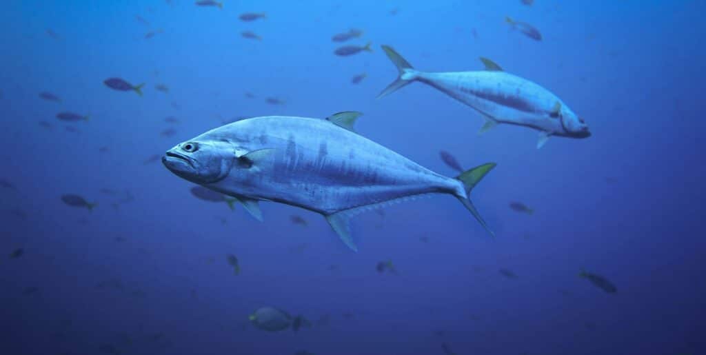
Millions of people in the Pacific rely on tuna for food, employment and national income. In the face of changes in ocean temperatures caused by climate change, a program led by UNSW Sydney is using commercial fishing vessels as observation platforms to help fishers monitor changes in ocean conditions and understand where tuna schools are located.
The Fishing Vessels as Ships of Opportunity Observing Program (FishSOOP), led by UNSW and integrated into the Integrated Marine Observing System, is expanding into the Pacific through a partnership with the Pacific Community (SPC). The initiative outfits tuna fishing vessels with Moana temperature sensors installed directly on nets and lines, which automatically measure water temperature below the surface during normal fishing operations.
“Tuna resources are fundamental to the region’s economy, food security and livelihoods. However, tuna populations are increasingly threatened by climate change, which is expected to alter their distribution and abundance, creating uncertainty for the communities that depend on them,” explains Moninya Roughan, an oceanographer at UNSW, cited in a press release.
“As tuna is a priority across the Pacific, SPC immediately recognized the potential of this program to make a real difference.”
By collecting ocean observations through the Pacific fishing fleet, including temperature data, the program aims to improve understanding of how ocean conditions are evolving, support more effective fishery management, and strengthen climate forecasts, including phenomena such as El Niño and extreme weather events.
See what happens below the surface
Although the oceans cover more than 70% of the Earth’s surface, major gaps remain in their monitoring. Satellites provide essential information, but they mainly measure surface temperatures, while commercially important species, such as tuna, can be found hundreds of meters deep.
“Satellites tell us what is happening at the surface, but that is not necessarily what is happening where the fish actually are,” says Roughan.
Commercial fishing vessels, on the other hand, traverse vast areas of the ocean daily and can collect data while carrying out their normal operations. “Unlike traditional research vessels, which are expensive and can only study limited areas over short periods, fishing boats can collect observations regularly over large areas while conducting their usual operations,” the researcher adds.
The sensors record temperature, pressure, location and time as the gear moves through the water. The data are transmitted by satellite a few minutes later, processed automatically and returned to the participating fishers.
The measurements reveal conditions hundreds of meters below the surface. Between 200 and 400 meters, the water temperature can be three to five degrees Celsius different from that recorded at the surface. This information can help fishers identify cooler waters and temperature gradients associated with better fishing conditions.
“It is giving fishers visibility into conditions they previously could not observe, effectively helping them to stop ‘fishing blind’,” says Moninya Roughan.
According to the researcher, some Pacific fishing companies have found the data sufficiently useful to request sensors for other vessels or to purchase their own equipment.
Data that help predict extreme events
The benefits of the project go beyond fishing activity. The observations collected by FishSOOP are shared in real time via the World Meteorological Organization’s Global Telecommunication System, making them immediately available to meteorological forecasting agencies around the world.
The data help improve estimates of the heat stored in the deep ocean layers, an important factor in predicting tropical cyclones, marine heat waves, ocean circulation and climate variability.
“Getting better information about the heat content of the oceans improves our ocean and atmospheric models,” explains Roughan. “Ultimately, this improves forecasts of tropical cyclones, storms and droughts, helping communities prepare for extreme weather events.”
The information collected also enables better study of marine heat waves and coastal processes, while fishery managers can cross the oceanographic data with catch information, when shared by fishers, to understand how changes in ocean conditions affect fishery resources.
Fisher knowledge strengthens science
One of the central features of the program is the relationship established between researchers and fishers. Rather than merely collecting data from the industry, the project was designed so that the fishers themselves receive the information first, which they can use to better understand the conditions that influence their catches.
For Roughan, this approach helped foster a relationship of trust between the two sides. During a visit to Papua New Guinea, the researcher witnessed an episode she regards as revealing: a Filipino captain showed another fisherman a folder with printed reports on ocean temperatures produced by the program.
“He couldn’t understand what they were saying. But, when they finished talking, the other captain gratefully picked up the equipment and installed it on his own vessel,” she says.
“It was a powerful reminder that the program’s strongest advocates are the fishers themselves. They are using the data. They are waiting for the data. If they do not receive them, they contact us.”
The researcher also notes that fishers possess deep knowledge of the relationships between ocean conditions and catches. “They really care about the ocean because their livelihoods depend on it. They also have extraordinary knowledge of the relationship between ocean conditions and their catches. Bringing that knowledge together with science makes both stronger.”
From a research project to a global network
FishSOOP was born, in 2017, out of a research need of Roughan herself. “In reality, I started this project because I needed more observations for my own research on the coastal ocean.”
Since then, the international network has grown from a few vessels in Australia and New Zealand to around 500 to 600 commercial fishing vessels in the Western and Central Pacific, the Indian and Southern Oceans, Brazil and Canada. There are also partners in Europe, the United States, the Caribbean and Africa who are developing similar work under the Fishing Vessel Observation Network.
The ambition now is to significantly expand this network.
“The vision is to create a truly global network of 10,000 commercial fishing vessels that will help us better understand the ocean and, ultimately, the communities around the world that depend on it,” concludes Moninya Roughan.