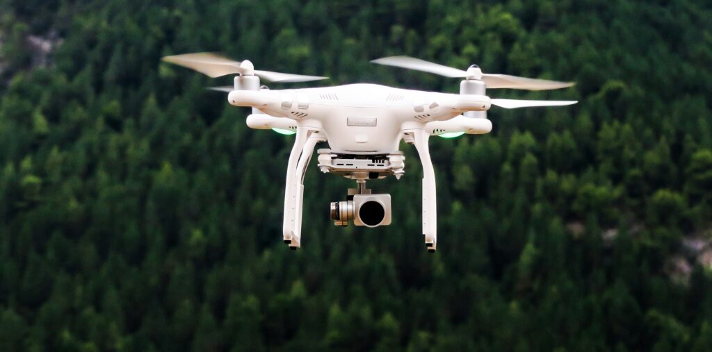
Following the rural wildfire of August 2024, the Government of Madeira acquired high-precision tools, notably professional drones, to map forest areas with levels of detail previously unattainable, indicated the Institute of Forests and Nature Conservation.
“This investment will complement the existing unmanned aerial means and will prove strategic to substantially reinforce the capacity to respond in monitoring, gathering geographic data and assessing intervention areas,” the institute said in a note sent to Lusa.
In the wake of the fire that raged on the island between 14 and 26 August 2024, the Institute of Forests and Nature Conservation (IFCN) also used drones to test the release of plant seeds in hard-to-reach areas.
The intervention took place in the forest perimeter of Lombo do Mouro, in the municipality of Ribeira Brava, near the area where the fire began, a site considered “representative of the ecological and topographical challenges of post-fire recovery.”
The IFCN tested the use of “seed bombs” to accelerate the regeneration of inaccessible areas, but early conclusions indicate that the original spherical-bomb model is unfeasible due to the “demanding topographic, climatic and biotic conditions” of the area.
Therefore, the model was redesigned, now focusing on disk-shaped matrices, the pre-treatment of seeds and the physical protection of the areas, considered essential to ensure technical feasibility and the success of future sowing operations.
The Institute of Forests and Nature Conservation has already installed 2,746 metres of fencing and three gates in the areas affected by the wildfire at Paul da Serra, at an investment of around 69 thousand euros.
“More than a physical barrier, this infrastructure has proven to be structural and indispensable for the protection of recovering spaces, halting the impact of unregulated grazing and ensuring the viability of forest restoration actions and natural regeneration,” the note says.
The regional authority adds that it has also promoted “intensive campaigns” to collect native seeds, which were “fundamental to safeguard the regional genetic heritage and to ensure the capacity to respond” at the level of sowing.
Regarding the new professional drones, acquired under the Recovery and Resilience Plan, the IFCN explains that they are equipped with thermal cameras, multispectral, photogrammetric cameras and LiDAR sensors, which will allow mapping forest cover with high precision.
The August 2024 fire raged for 13 consecutive days and covered an area of 5,116 hectares, across the municipalities of Ribeira Brava, Ponta do Sol, Câmara de Lobos (in the western area) and Santana (on the northern coast), where it reached the central mountain range, with about 84% of the burnt area having slopes of 50% or more, located on steep slopes and very difficult-to-access zones.
The use of drones in the ecological restoration process is, therefore, being evaluated and tested by regional authorities.
The fire also consumed 139 hectares of laurisilva forest, which is UNESCO World Heritage and occupies a total of 15,000 hectares.
The firefighting operation involved more than a thousand personnel and two Canadair aircraft, activated through the European Civil Protection Mechanism, but there were no reports of injuries or destruction of homes and essential public infrastructure.
The IFCN says it mobilized a “progressive and sustained” on-the-ground response immediately after the fire, aimed at the immediate recovery of the affected areas, but also at the “structural strengthening of the resilience of ecosystems, of forested landscapes and of the regional capacity for prevention and response to future fires.”
“The work carried out has rested on an integrated approach, combining stabilization and erosion-control interventions, forest recovery and reconversion, protection of areas in regeneration, collection and preservation of native seeds, technological monitoring, strengthening of human resources and the development of new instruments for planning and integrated management of rural fire,” he adds.